Preserving history: digitising heritage buildings with drone photogrammetry
Capturing the Past, Protecting the Future
The preservation of historic buildings is a complex and meticulous process, requiring accurate documentation and ongoing maintenance to ensure their longevity. At Skytech Cambridge, we work alongside heritage and conservation organisations to revolutionise the way these structures are surveyed and maintained. Using cutting-edge drone technology and photogrammetry, we create detailed 3D models that provide invaluable insights for conservation professionals.
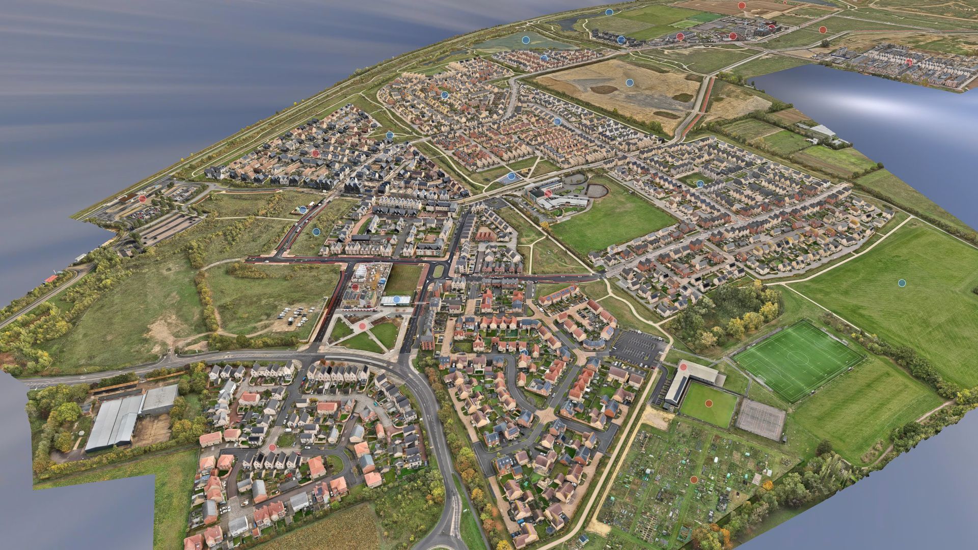
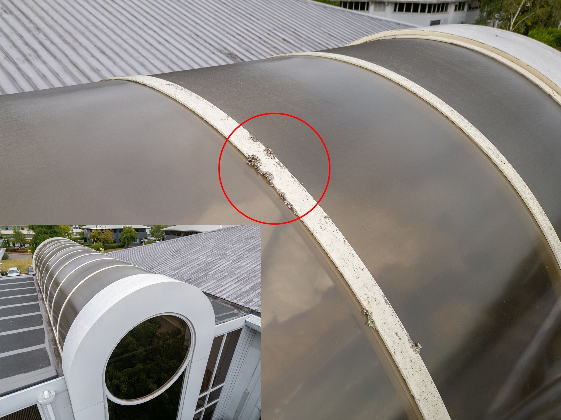
Traditional surveying methods for historic buildings can be time-consuming, costly, and, in some cases, physically challenging. Many heritage sites feature intricate architectural details and hard-to-reach areas that make manual inspections difficult. We deploy the DJI M300 with its high resolution full frame P1 camera and the DJI Matrice 4 Enterprise, both engineered for capturing ultra-sharp imagery with exceptional clarity. Their precise geotagging capabilities ensure accurate alignment of data, while optimised pre-programmed flight paths enable seamless and efficient coverage of even the most intricate architectural details. This combination allows us to produce highly detailed 3D models tailored for heritage conservation and analysis.
Our work enables conservationists, architects, and restoration specialists to examine buildings in unprecedented detail without the need for intrusive scaffolding or costly site visits. The 3D models not only provide a comprehensive visual record but also assist in planning restoration work, monitoring structural integrity, and supporting maintenance programmes.
Case Study: St Peter and St Paul's Church, Dry Drayton, Cambridgeshire
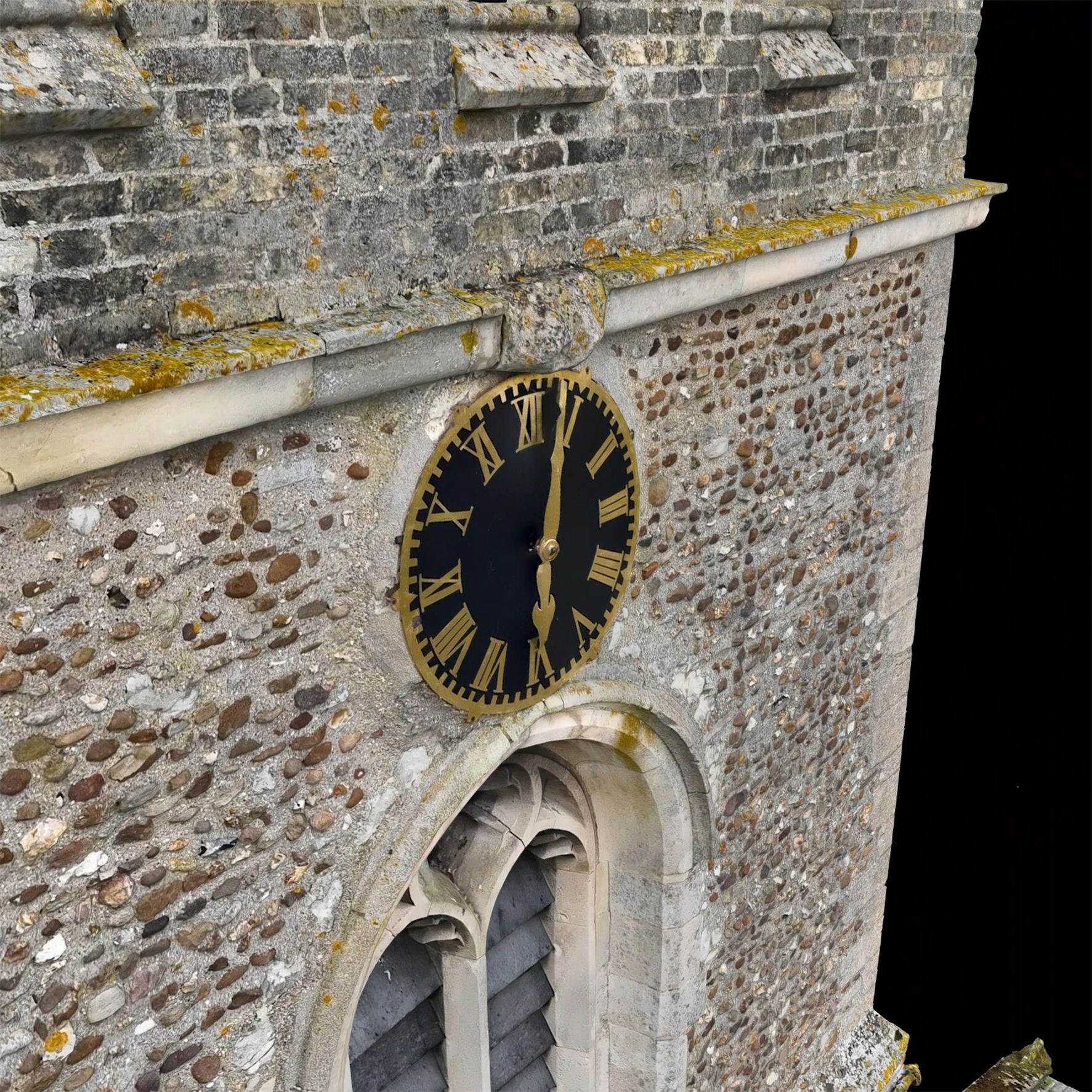
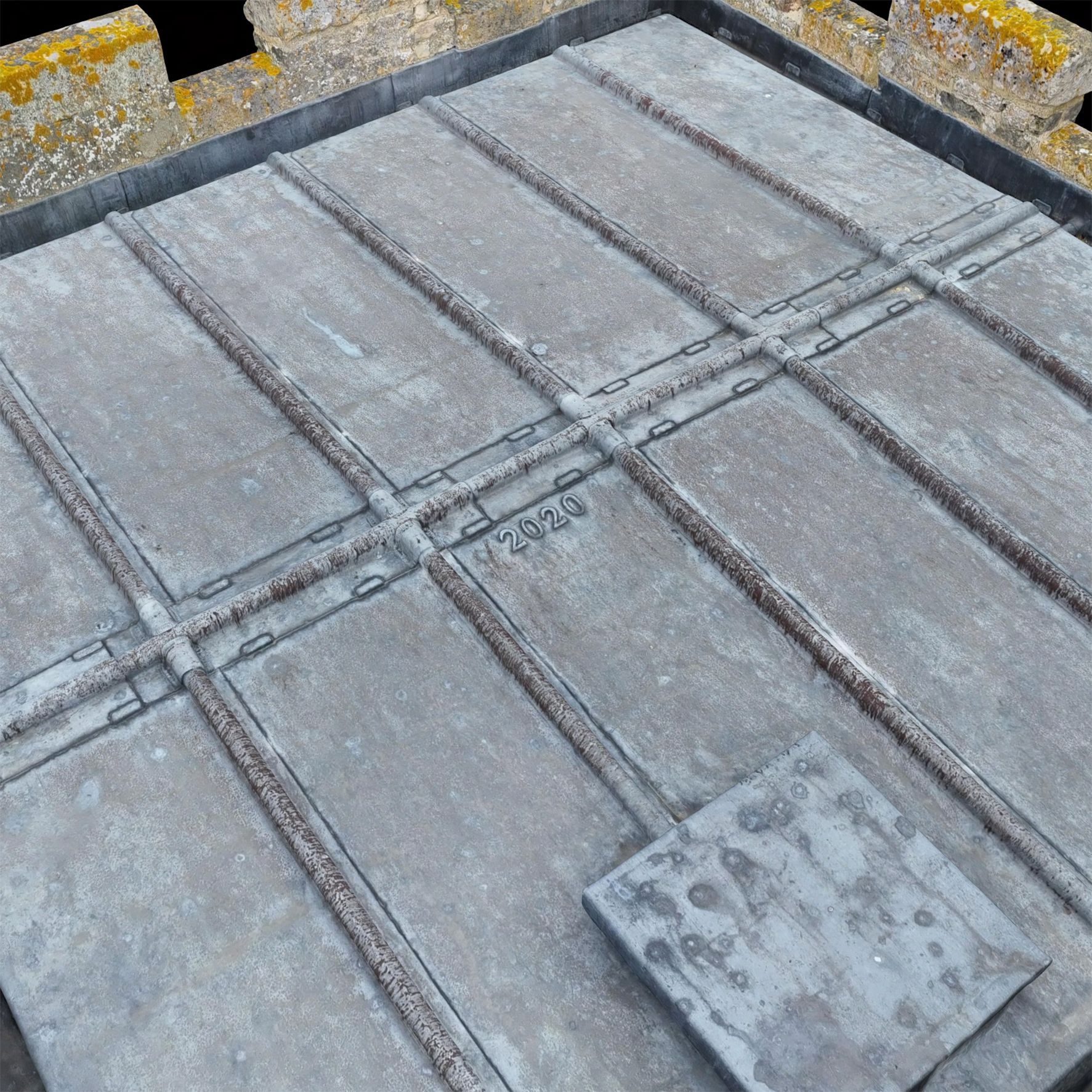
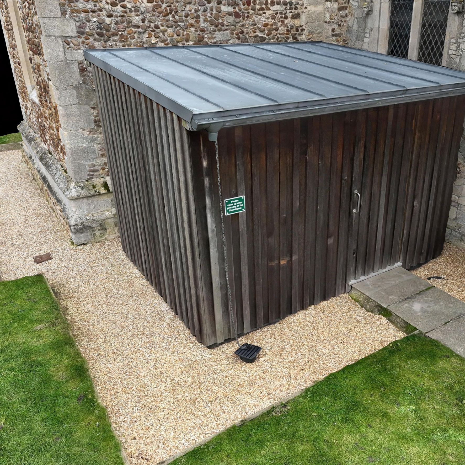
One of our recent projects involved capturing and digitising St Peter and St Paul's Church in Cambridgeshire. This historic structure required a thorough survey to support ongoing conservation efforts, and our drone-based approach offered an efficient and non-invasive solution.
Through a combination of aerial photography and advanced photogrammetry techniques, we created an extraordinarily detailed 3D model of the church, enabling conservationists to examine every aspect of its architecture.
By providing a detailed, interactive digital twin of the church, we have helped streamline conservation efforts, allowing stakeholders to assess structural conditions, identify potential areas of concern, and plan necessary maintenance more effectively than ever before.
The result was met with enthusiasm by the building conservator, who remarked:
"The 3D model provided by Skytech Cambridge is extraordinary, with an incredible level of detail. It will be an invaluable tool in supporting the church architect with our quinquennial maintenance programmes"
A fully functional interactive 3D model is available to view online HERE. It is best viewed on a PC, Laptop or Tablet but will also work on small mobile devices.
The Future of Heritage Conservation
The application of drone photogrammetry in heritage preservation is transforming the way conservation work is carried out. As technology continues to evolve, these digital models will become even more advanced, offering new possibilities for education, virtual exploration, and public engagement with historic sites.
At Skytech Cambridge, we are committed to supporting the heritage sector with innovative aerial imaging solutions. Our work ensures that the architectural legacy of the past can be protected and appreciated for generations to come.
Click here to learn more about our 3D mapping and digital preservation: Skytech Cambridge 3D Mapping & Panoramas.