Drone Surveying And Mapping

7 Tips for Finding the Right Drone Surveying Company


In recent years, drone technology has revolutionised various industries such as surveying and mapping. Drone surveys provide a new perspective, providing accurate and detailed data for a wide range of applications. In this blog, we'll look at the benefits of drone surveys and provide seven valuable tips to help you find the right drone surveying company for your project. Get ready to elevate your surveying endeavours to new heights!


Understanding the Power of Drone Surveys


Increased Efficiency and Cost Savings

Drone surveys streamline the surveying process by capturing high-resolution aerial imagery and data quickly and efficiently. This eliminates the need for traditional, time-consuming manual surveys and reduces costs associated with labour and equipment.


Safety and Accessibility

Drone surveys eliminate the need for surveyors to physically access challenging or hazardous terrains. With drones, inaccessible areas, steep slopes and unstable ground can become accessible, reducing potential risks and enhancing safety.


Accurate and Detailed Data

Drones equipped with advanced sensors and cameras provide incredibly precise data and imagery. These surveys offer detailed topographic mapping, 3D models and orthomosaic images, allowing for accurate measurements, volumetric calculations and analysis.


7 Tips for Finding the Right Drone Surveying Company


Experience and Expertise

Look for a drone surveying company with a proven track record and extensive experience in your industry or specific project type. A company with in-depth knowledge of surveying principles and regulations can provide more accurate and reliable results.


Licensing and Certification

Ensure that the drone surveying company holds the necessary licenses and certifications to operate legally and safely. 


Portfolio and References

Review the company's portfolio to assess the quality and diversity of their previous surveying projects. Request references or testimonials from their clients to gain insights into their professionalism, expertise and customer satisfaction.


Data Processing and Reporting

Ask about the company's data processing capabilities. Effective data processing and analysis play a vital role in extracting meaningful insights from the collected survey data. A company that offers comprehensive reporting and analysis services can provide valuable information for your project.


Communication and Collaboration

Choose a drone surveying company that values clear and open communication. Effective collaboration ensures that your project requirements are understood and met. The company should be responsive to your inquiries and provide regular updates on the progress of the survey.


Equipment and Technology

Inquire about the drone surveying company's equipment and technology. Modern drones equipped with advanced sensors and cameras can capture high-resolution imagery and collect accurate data. A company that invests in state-of-the-art equipment demonstrates a commitment to delivering high-quality results.


Insurance Coverage

Ensure that the drone surveying company carries appropriate insurance coverage, including liability insurance. This protects both parties in the event of any unforeseen incidents or accidents during the surveying process.


So, as we can see, drone surveys have transformed the field of surveying and offers improved efficiency, accuracy and safety. By finding the right drone surveying company, you can unlock the full potential of this technology for your projects. Consider their experience, licensing, equipment and data processing capabilities. By choosing a professional and reliable partner, you can harness the power of drone surveys to gather precise data, gain valuable insight and enhance your decision-making processes.

view model in 3d

At Skytech Cambridge We Know a Thing or Two About Drone Surveying and Mapping


While our base is in Cambridge, we are proud to undertake projects throughout the United Kingdom and around the globe. As a CAA GVC Authorised Drone Operator, we adhere to a rigorous health and safety policy, ensuring the utmost safety throughout our operations.


We are deeply enthralled by the wonders of technology. Over time, it has bestowed upon us the ability to deliver exceptional content and data to our esteemed clients. Whether you seek captivating cinematic footage, intricate inspections, extensive surveys, or breath-taking photographs, our team possesses the expertise and cutting-edge equipment necessary to execute projects with utmost precision and excellence.


Our team boasts extensive experience and holds commercial drone pilots' licenses and UAV operational qualifications. Rest assured; you are in capable hands. We prioritise safety above all else, meticulously planning each project to guarantee not only the finest shots but also a secure environment.


Whatever you need from our team, we’re certain we can deliver the results you need. We can offer services such as
Photography and Filming, Drone Survey and Inspection, 
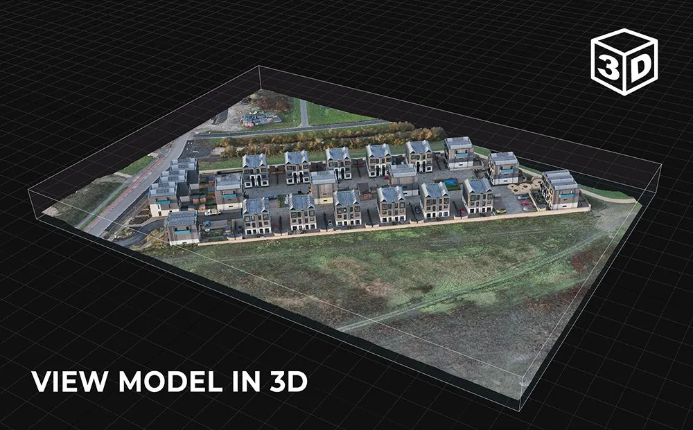
Drone 3D Mapping and Modelling, Drone Security Services, Thermal Imaging and 360° Drone Panoramas.


We offer a range of services at varying costs and eagerly await to hear about your unique ideas. Reach out to our team today to discuss your project and we’ll do all we can to give you the outcome you need. 


Whether you choose to complete the
contact form or prefer a friendly conversation, you can contact us at 01223 633602 or 07860 565974. We look forward to hearing from you!

Get in touch to discuss your next project!

Contact Us
Share by: