Cambridge Airport Sale Could Reshape the City and Drone Operations Above It
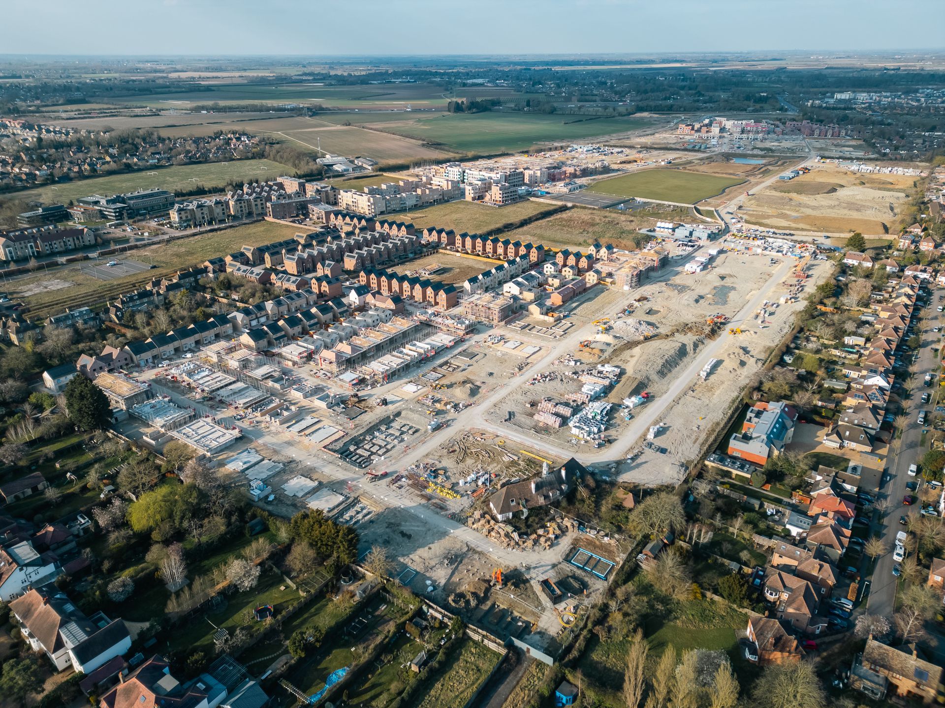
The sale of the Cambridge Airport site marks one of the most significant development announcements for the city in a generation. Homes England, through its National Housing Bank, and The Hill Group have completed the acquisition of Cambridge East from Marshall Group, paving the way for a major new urban quarter on the eastern edge of Cambridge.
The site extends to approximately 700 acres and includes Cambridge City Airport and surrounding land. Current plans indicate that Cambridge East could deliver more than 10,000 new homes, at least 3 million sq. ft. of commercial space, community facilities, schools, healthcare provision, green spaces and around 9,000 jobs. Marshall is expected to relocate its airport operations by mid-2029, with the first phase of up to 500 homes currently projected to start from 2029, subject to planning and funding.
The proposals also include the potential for a new Cambridge East railway station, which could improve links into central Cambridge, London and the wider Oxford-Cambridge Growth Corridor. The development has been described as one of the UK’s largest urban extension projects and represents a major change for land that has played an important role in Cambridge’s aviation and industrial history for more than a century.
What this could mean for drone operations in Cambridge
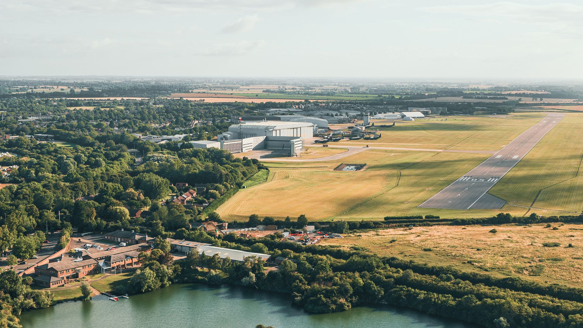
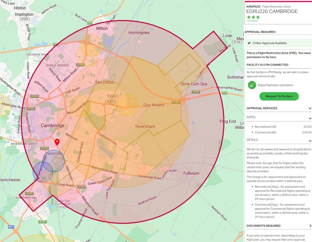
At present, a large part of Cambridge sits within the Flight Restriction Zone, or FRZ, associated with Cambridge City Airport. Any drone operator intending to fly within the airport’s FRZ must obtain prior permission from the team at Marshalls. The FRZ is active 24 hours a day, seven days a week, and applies to small unmanned aircraft of any mass, even small hobbyist drones.
When Cambridge City Airport closes and the associated FRZ is eventually removed, this would represent a significant change for drone activity in and around the city centre. For some drone users, particularly recreational pilots, the removal of the airport restriction will make it easier to fly in areas that currently require permission. It will reduce one layer of administration for some commercial drone work as well, particularly for operations that currently require airport approval before they can take place.
From a professional standpoint, the change could bring both advantages and disadvantages. Skytech Cambridge operates frequently across Cambridge city centre and the surrounding areas, and we are already used to working within the current FRZ system. While the permission process adds administration, it also creates a useful barrier that discourages casual or poorly planned drone flights in sensitive urban areas.
If the FRZ is removed in future, it goes without saying that more members of the public will fly drones in the city centre. This could make commercial drone operations more difficult to manage, not because professional permissions would necessarily be harder to obtain, but because there may be a greater need to mitigate the risks created by other drone users operating nearby.
For commercial operators, this could mean more pre-flight checks, more detailed airspace monitoring, greater public engagement on site, and a higher likelihood of having to pause or adapt work if an uncoordinated drone flight takes place in the same area. In busy urban locations, the safety of uninvolved people, property and other airspace users remains the priority.
The potential removal of the Cambridge Airport FRZ could therefore be positive in terms of reducing one specific permission requirement, but it may also increase the importance of professional planning, risk assessment and on-site control. As Cambridge continues to grow and develop, responsible drone operations will remain essential, particularly in a city with complex architecture, high public footfall and many sensitive locations.