
Drone Thermal Imaging
What is Thermal Imaging?
Thermal imaging, also known as infrared thermography, is a non-invasive technology that uses a specialized camera to measure the temperature of objects or surfaces.
Thermal imaging cameras detect the infrared radiation, or heat, emitted by objects and convert it into visible images that show temperature variations. These images can be used to identify areas that are hotter or cooler than their surroundings, which can be helpful for a variety of applications, including identifying energy loss in buildings, detecting electrical problems, and finding hidden water damage.
Thermal imaging can also be used in medical and industrial applications, as well as for search and rescue operations.
High resolution radiometric drone
images and video
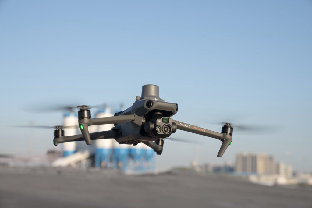
SkyTech Cambridge offers the latest thermal imaging technology, fully integrated into a purpose built drone, with an industry leading 640 x 512 high resolution sensor to produce high quality and reliable thermal images and video.
Images captured are fully radiometric which means that every pixel in the image contains a temperature value. This allows for more detailed post-capture data analysis and flexibility.
Thermal drone inspections can be conducted safely in confined and difficult to access areas both internally and externally; complete darkness; cold weather and remote locations. Deployable in under a minute and with a flight time of up to 25 minutes per battery - a quick response is assured to capture the data that you need.
Traditional handheld thermal devices are an invaluable tool for many reasons, however they are limited by the fact that they can only be used by an operator on the ground. The same technology is now operational on our dedicated thermal imaging drone which provides unrivalled access to buildings and infrastructure previously deemed too challenging to inspect.
Drone thermal inspection and survey
We can perform thermal aerial inspections to cover a number of different scenarios
- Roof inspection - detect defects resulting in air/heat escape or moisture/water ingress.
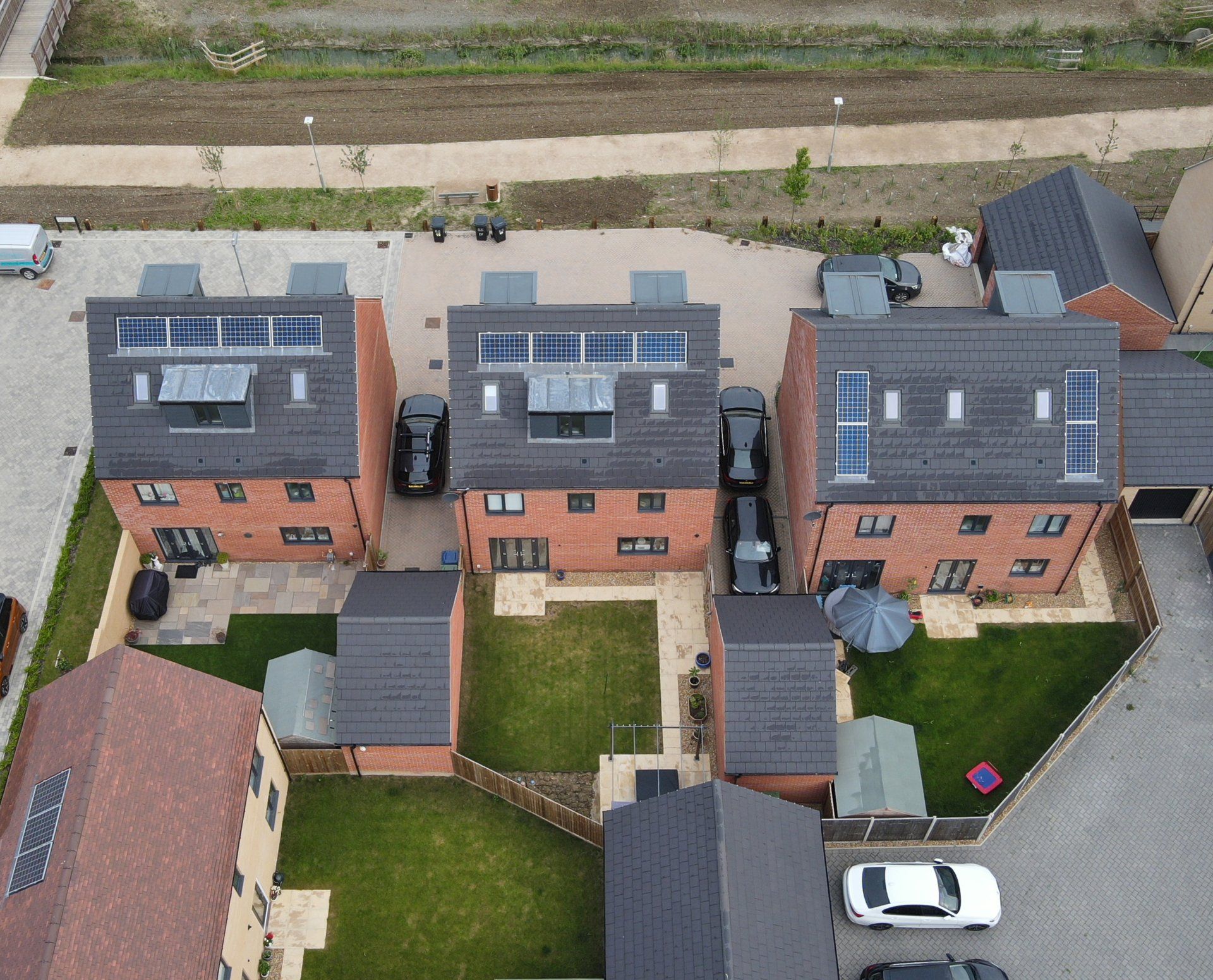
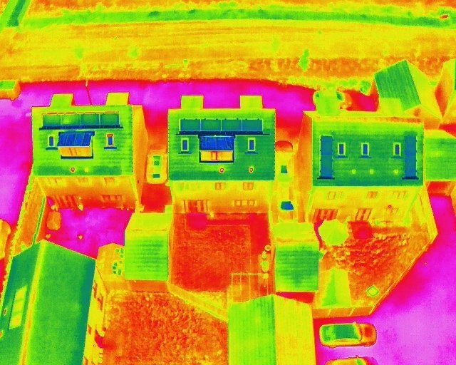
- Building envelope inspection - detect hot/cold spots to identify poor insulation or construction and thermal bridging. Particularly useful on new build houses where construction standards haven't been adhered to correctly.
- Solar panel inspection - the high resolution sensor, with an impressive measurement accuracy of ±2°C, is suitable for detecting faulty cells on solar arrays which are impossible to see with the naked eye as well as any debris on the surface of the panel itself which could potentially cause damage.
- Farming and Agriculture - a thermal imaging drone is able to operate at night and can cover an area of approximately 80 acres at a maximum operating height of 400ft above ground level. This makes the thermal drone the perfect tool for locating livestock when missing or to monitor new born animals from a safe distance; identify livestock predators and their habitats and for security projects relating to farming theft.
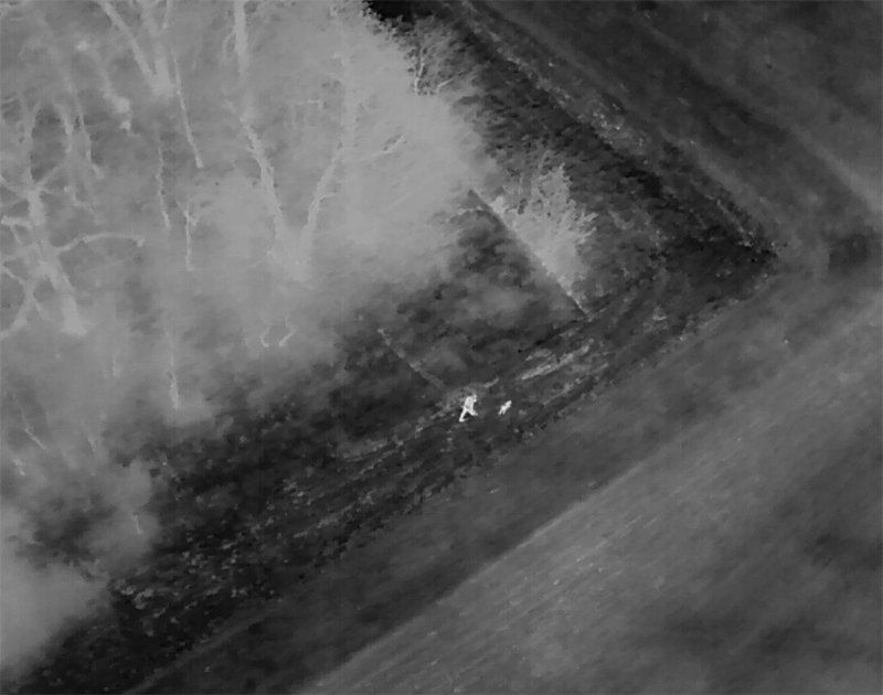
- Search and Rescue - with the added functionality of a high powered LED spotlight, the thermal drone is an invaluable tool for locating missing people (only in conjunction with the relevant emergency services) and animals such as domestic pets.
- Urban day and night operations - security and monitoring operations in urban environments for private companies as well as assisting local emergency services. Ultra quick deployment, up to 25 minutes flight time per battery and the ability to simultaneously record in standard 4K video and thermal imaging video.
- Asset inspection - aerial thermal imaging can also be used proactively to detect and prevent future costly issues from arising on a variety of assets.

Thermal imaging in Construction
Thermal imaging in construction can be used to detect and diagnose a variety of issues related to building performance and energy efficiency. Some common applications of thermal imaging in construction include:
- Identifying areas of heat loss or air infiltration in the building envelope: By using a thermal imaging camera to scan the exterior of a building, it is possible to identify areas where heat is being lost through the walls, roof, or windows. This can help to identify areas that may need additional insulation or sealing to improve energy efficiency.
- Detecting moisture or water damage: Thermal imaging cameras are sensitive to temperature differences, which can make them useful for detecting moisture or water damage in building materials. By scanning walls, ceilings, and floors, it is possible to identify areas where moisture may be present, which can help to prevent further damage or decay.
- Inspecting electrical systems: Thermal imaging cameras can be used to detect overheating in electrical systems, which can indicate issues such as faulty wiring or overloaded circuits. This can help to prevent fires or other electrical accidents.
- Monitoring the performance of HVAC systems: Thermal imaging can be used to identify areas of the building where the heating or cooling system is not performing efficiently, which can help to identify problems and improve energy efficiency.
Thermal imaging for Solar Array inspection
Thermal imaging equipped drones can be used to inspect solar panels by looking for areas of the panel that are producing less heat than the surrounding areas. These cool spots may indicate a malfunction or damage in the panel, which can affect its efficiency.
To use thermal imaging to inspect solar panels, the technician would first need to set up the thermal imaging camera and ensure that it is calibrated properly. The technician would then aim the camera at the solar panels and scan them for any areas of abnormally low heat. These areas can be further investigated to determine the cause of the issue and whether the panel needs to be repaired or replaced.
Thermal imaging is a non-invasive and non-destructive way to inspect solar panels, as it does not require any disassembly or direct contact with the panels. This makes it an effective and convenient tool for identifying problems with solar panels and ensuring that they are functioning at their optimal level.
Thermal imaging for Agriculture and Farming
- Monitoring animal health: Thermal imaging can be used to detect signs of illness in livestock, such as fever or inflammation. This can help farmers to identify and treat sick animals before the illness spreads to the rest of the herd.
- Detecting plant stress: Thermal imaging can be used to detect changes in the temperature of plants, which may indicate that the plant is under stress or experiencing problems. This can help farmers to identify and address problems with their crops early on, which can improve yields and reduce losses.
- Detecting irrigation issues: Thermal imaging can be used to detect uneven irrigation, which can lead to areas of the field that are too wet or too dry. This can help farmers to optimize their irrigation practices and improve crop health.
- Detecting pests and diseases: Thermal imaging can be used to detect the presence of pests or diseases on plants, as these can cause changes in the temperature of the plant. This can help farmers to identify and address these problems early on, which can prevent widespread damage to the crop.
Thermal imaging for Search and Rescue
This technology can be used in search and rescue operations to help locate people who may be lost or trapped in a variety of situations, such as after a natural disaster, in a building collapse, or in the wilderness.
Thermal imaging cameras work by detecting the infrared radiation emitted by objects, which is not visible to the human eye. The camera converts this radiation into an image that can be viewed on a screen, with different colors representing different levels of heat.
One of the primary advantages of using thermal imaging for search and rescue is that it allows rescuers to locate people who may be hidden or difficult to see with the naked eye. For example, if a person is trapped in a building collapse, they may be hidden behind debris or in a small pocket of space that is not easily visible. Thermal imaging cameras can detect the heat emitted by the person's body, even if they are hidden from view, and help rescuers locate and rescue them.
Thermal imaging can also be useful in search and rescue operations in other ways. For example, it can help rescuers locate and follow the heat signatures of animals, such as pets that may have been lost or trapped in a disaster. It can also be used to detect hot spots in fires, helping firefighters to locate and extinguish the fire more quickly and efficiently.